
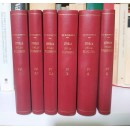
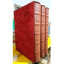
ATTENZIONE: LEGGERE TUTTO!
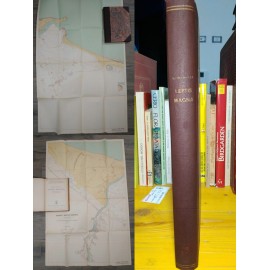
USATO. SEGNI DELL'USO (qualche rara traccia di contatto delle pagine con i polpastrelli). Qualche lentiggine e brunitura al margine delle pagine, in una pagina due piccole linee tracciate a penna.
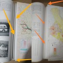
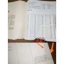
ATTENZIONE: libro certamente usato (e molto usato) a scopo didattico, di conseguenza un gran numero delle cartine (solo le cartine) geografiche a tutta pagina, come dimostrano le foto, sono state STACCATE (con il taglierino) dal volume, ma sono tutte presenti, sciolte. Alcune di queste cartine sciolte risultano molto usate e manipolate, con qualche stropicciatura e un certo logoramento dei margini (in un caso con piccoli strappetti, ma senza mancanze).
Volume raro e molto costoso, qui sottoprezzo per i difetti elencati.
WARNING: This books has been certainly used (and very much so) as teaching material and therefore many geographical map in the book (maps only) have been removed from the book as shown by the pictures. They are, however, available and present as loose items.
Some of these maps have been heavily used and manipulated and appear to be wrinkled and worn (with some minor tears on one of them, without missing pieces)
Very rare and valuble book, it is being sold underprice bacuse of the aforementioned defects.
da 100,00 €
Info

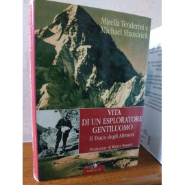
Mirella Tenderini e Michael Schandrick
prefazione di Walter Bonatti
Corbaccio 2006
rilegato con sovraccoperta, usato. Riccamente illustrato
Nato a Madrid nel 1873, terzogenito del re di Spagna Amedeo d'Aosta, Luigi Amedeo, si dedicò fin da giovanissimo alle sue grandi passioni: l'avventura e l'esplorazione. Conclusa l'Accademia navale, viaggiò per mare in tutto il mondo e fra il 1897 e il 1899 realizzò le sue prime spedizioni importanti in Alaska, di cui la seconda raggiunse la latitudine Nord più avanzata dell'epoca. Tra il 1903 e il 1905 circumnavigò la terra passando per lo stretto di Magellano, toccando Cina e Australia e tornando per il mar Rosso. Nel 1906, in veste di alpinista, riuscì a raggiungere le cime più alte della catena del Ruwenzori, vicina alle sorgenti del Nilo.
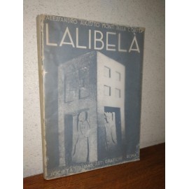
ALESSANDRO AUGUSTO MONTI DELLA CORTE
LALIBELà
LE CHIESE IPOGEE E MONOLITICHE E GLI ALTRI MONUMENTI MEDIEVALI DEL LASTA
con una introduzione del Governatore italiano dell'Amara, Luigi Frusci
fotografie e rilievi del centurione Elio Zacchia, disegni originali di Lino Bianchi-Barriviera.
pp. 184, XLII tavole b/n f.t., nn. illustrazioni b/n, nn. tavole ripiegate b/n f.t.,
SOCIETà ITALIANA ARTI GRAFICHE- ROMA
15 OTTOBRE 1940, XIII E.F.
Un'opera di ricerca archeologica religiosa promossa dal conte Alessandro Augusto Monti della Corte di Nigoline sul territorio del governatorato dell'Amara, Africa Orientale Italiana, parte dell'Impero Italiano d'Etiopia, sotto gli auspici del governatore dell'Amara Luigi Frusci.
Opera ricca di immagini, foto, cartine, mappe, planimetrie, ricostruzioni grafiche.
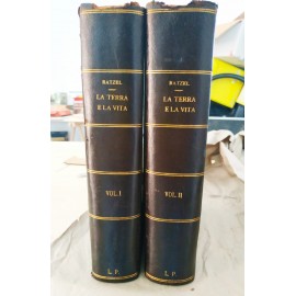
LA TERRA E LA VITA. Geografia comparativa.
prima traduzione italiana, a cura di
Aristide Cignolini, lingua tedesca; Mario Lessona, storia naturale
Torino, Unione Tipografica Editrice UTET
1905-1907
2 tomi
tomo 1: 860 pp, 9 carte geografiche, 9 tavole a colori, 14 tavole in nero, 264 fig. nel testo
tomo 2: 836 pp, 12 carte geografiche, 10 tavole a colori, 13 tavole in nero, 233 fig. nel testo
Rilegati in mezza pelle con filettature e caratteri dorati, piatti goffrati
Magnifiche le illustrazioni d'arte a colori, su carta pregiata, rugosa, protetta da un foglio di pergamino
Del padre della geografia politica e precursore della geografia umana, un vero trattato pionieristico di "scienze della terra" e geologia, geofisica, demografia e cartografia
UMBERTO NOBILE
L'ITALIA AL POLO NORD
MONDADORI 1930, terza edizione stesso anno della prima
172 illustrazioni fotografiche e grafici; 2 magnifiche foto panoramiche "a volo d'uccello" più volte ripiegate
entrambe le cartine geografiche dimostrative ripiegate.
Rilegatura coeva d'amatore (piatto dell'originale in brossura conservato sciolto nel volume), in mezza tela, caratteri dorati al dorso e piatti marmorizzati. PP 480+XX
Raggiungere il Polo Nord con un dirigibile per compiere rilevamenti geografici e scientifici: perciò Nobile progettò l’'Italia' e organizzò una nuova spedizione aerea polare, dopo quella effettuata con successo del Norge. L’impresa ebbe però esito tragico: il 23 maggio 1928 l’aeronave precipitò, 7 uomini morirono e i superstiti portati in salvo solo il 12 luglio
VOLUME RARISSIMO, RICCO DI DATI E IMMAGINI INEDITE
Opera ufficiale, di origine governativa, e al contempo tecnica, architettonica e ingegneristica del Genio Civile di Tripoli, documenti, con una enorme raccolta di immagini rare, grafici, progetti, mappe, cartine più volte ripiegate (anche a 10 facce), che raccontano nel dettaglio la "costruzione dell'Impero" fascista nell'Africa Italiana, nella Tripolitania e Libia, e il suo ammodernamento infrastrutturale extra-urbano
Rilegatura pregiata in stoffa serica, caratteri argentati impressi al dorso e al piatto. 150 pp testo illustrato + 48 pagine di tavole con centinaia di foto + raccolta di grandi mappe ripiegate.
brossura con alette, 127 pp
9788845901690
Sbarcato nel 1666 a Livorno, di ritorno dalla Cina, dove aveva soggiornato tre anni, il padre gesuita Johann Grueber si incontra a Firenze con due letterati pieni di curiosità e interesse per le «cose della China»: la conversazione si prolunga fino a notte fonda e tocca gli aspetti più importanti e singolari della vita in quel paese, dagli uffici dei magistrati alla maniera «strana e crudele» di eseguire le pene, da quale «ordine tenga il re con le sue donne» CONTINUA IN SINOSSI
storico delle lingue minoritarie
rilegato con sovraccoperta, pp 625, cm 14x23
IN UNA RARA EDIZIONE LUSSO, IN GRANDE FORMATO A TIRATURA LIMITATA
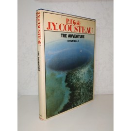
LE ESPLORAZIONI SOTTOMARINE DI JACQUES-YVES COUSTEAU
116 fotografie a colori su carta patinata
37 illustrazioni disegnate in bianco e nero su carta ruvida
8 cartine geografiche e marittime
rara IIª Edizione - diversa dalla Iª, di minor pregio - in formato maxi e lusso, stampata da Longanesi nel 1974
collana "La vostra via sportiva" 33
traduzione Elena Bona
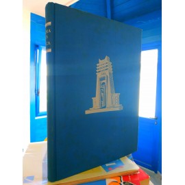
rilegata in pelle editoriale goffrata blu, caratteri argentei al dorso, sovraccoperta; 19x26,5, pp 300
TRE ESPLORAZIONI DEI PIù MISTERIOSI FONDALI OCEANICI DEL PACIFICO
(leggi il sommario e recensione in Sinossi)
a cura della Direzione Centrale degli Affari Coloniali del Ministero Degli Affari Esteri,
Ufficio Studi Coloniali
su incarico di S.E. il Governatore
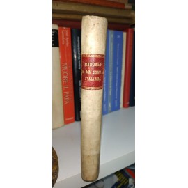
cm 13x18,5
pp 305
rilegato in mezza pelle; piatti marmorizzati
L'opera è divisa in due parti: una dedicata alla legislazione studiata in 15 capitoli. La seconda dedicata al Personale, in 6 capitoli. "Il presente Manuale è pubblicato per disposizione di S.E. il Governatore della Somalia Italiana, al fine di diffondere la conoscenza delle leggi, dei regolamenti e dei decreti vigenti in colonia, sia per uso delle autorità e dei funzionari che dovranno curarne l'applicazione, sia per ausilio degli studiosi di legislazione coloniale"
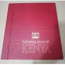
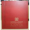
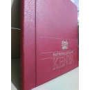
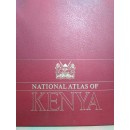
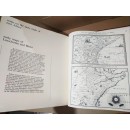
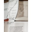
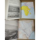
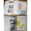
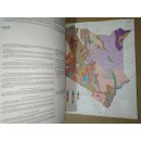
IL PRIMO ATLANTE NAZIONALE DEL KENYA INDIPENDENTE
NATIONAL ATLAS OF KENYA
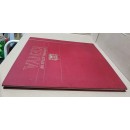
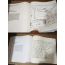
In folio, 41x38,5, rilegato in tutta pelle rossa, caratteri dorati al dorso, pp 105, di cui 95 mappe a tutta pagina. Con notizie su tutto il patrimonio o le risorse naturali, economiche, fisiche del Kenya.
Molte delle mappe staccate di proposito, ma tutte presenti come sciolte.
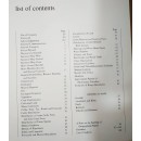
102pp, 95 maps. Publisher's original red boards. Third Edition. Atlas Folio - 385 x 410mm. comprehensive series of new & authentic maps prepared by the National Survey & other sources, gazetteer and notes on pronunciation and spelling. Ethnographic, game reserves, soil & natural features, exploration, transport, etc., as well as historical maps.
IL PRIMO ATLANTE NAZIONALE UFFICIALE DEL KENYA INDIPENDENTE, compilato e fatto stampare dal governo kenyota
The 3th edition of the "National Atlas of Kenya" is fully in English. Oversized. Contains chapters Geography of Kenya; History of Kenya; Geology of Kenya; Weather and Climate; Water Resources, Environment and Forests; Land and Soils; Agriculture, Livestock and Co-operative Development; Energy; Regional Development; Land Information and Management; Population and Human Resources; Tourism and Wildlife; Education and Training; Health Services; Economy, Banking and Finance; Trade and Industry; Transport, Communication and Broadcasting; International Relations; Gender, Sports, Culture and Social Services; Democracy, Governance and Politics; Law, Justice and Security